MapInfo Pro
Solution designed to help users visualize, analyze, and interpret spatial data easily
By combining advanced geospatial analytics with intuitive mapping tools, MapInfo Pro enables organizations to visualize, analyze, and interpret location data with confidence—transforming complex geographic information into clear, actionable insights for better decision-making.
Its scalable architecture and user-friendly interface allow users to model scenarios, uncover patterns, and perform analyses such as site selection, risk assessment, and demographic studies within a single platform. With support for diverse data formats and seamless integration with enterprise systems, it fits easily into existing workflows.
Enhanced with capabilities like drone data integration, geocoding, and automation through Python and MapBasic, it helps streamline processes and improve productivity. Widely used across industries including government, banking, utilities, and telecommunications, it empowers organizations to understand the “where” and act with confidence.
Features

Smart Mapping & Spatial Analytics
Powerful tools to visualize, query, and analyze geographic data, uncovering patterns and relationships across locations

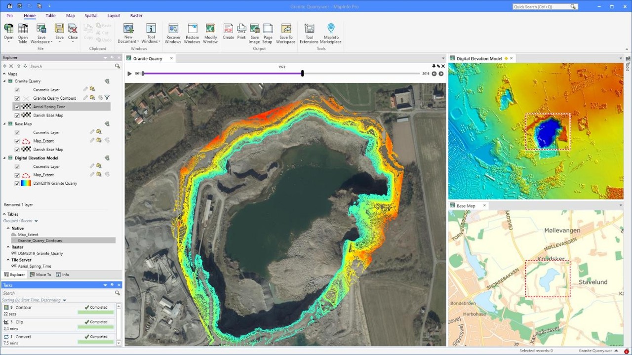
Drone & Raster Data Integration
Supports high-resolution imagery from drones and satellite sources for accurate environmental and infrastructure mapping

Python & MapBasic Scripting
Enables automation, customization, and integration with existing systems through flexible scripting capabilities

Geocoding & DriveTime Analysis
Converts addresses into geographic coordinates and performs routing, proximity, and service coverage analysis

MapInfo Pro Viewer
Allows users to open and interact with maps without a full license, improving accessibility across teams

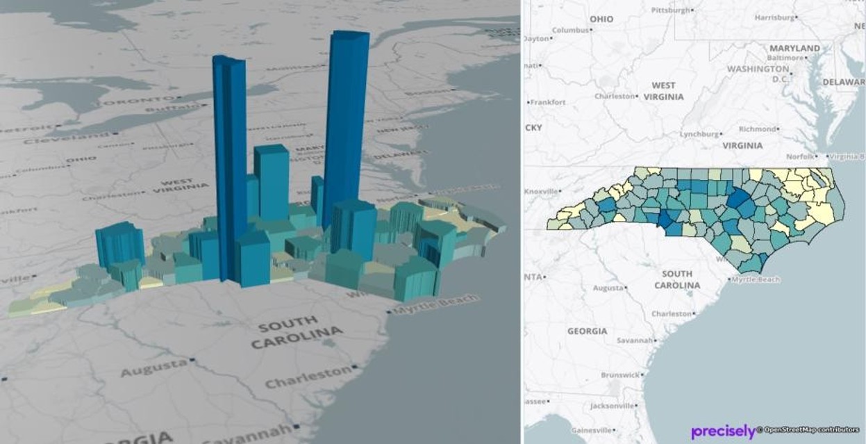
2D & 3D Visualization
Visualize spatial data in both traditional 2D maps and advanced 3D environments for deeper analysis
Use Cases
Explore Insights That Inspire Impact with MapInfo
Location Analysis & Planning
Identify optimal locations based on demographic, infrastructure, and geographic factors
Asset & Infrastructure Mapping
Manage and analyse locations of assets such as roads, utilities, and facilities
Urban & Regional Planning
Support zoning, land use analysis, and development planning initiatives
Market & Customer Analysis
Gain insights into customer distribution, catchment areas, and market potential
Environmental & Land Analysis
Map environmental data, land usage, and spatial impact assessments
Public Safety & Operations
Monitor and visualize incidents, coverage areas, and operational zones effectively
Industries
The Power of Location Data: Driving Business Value with Spatial Analytics
September 12, 2024
What Human Mobility Data Means to MapInfo Pro Users
October 19, 2022
Enterprise Location Intelligence with Spectrum Spatial
June 10, 2021
Loading, visualizing, and querying vector and raster data in MapInfo Pro
Jun 16, 2025
Creating Outside Buffers on Polygons
May 11, 2024
Airport Zones in 3D
Feb 27, 2024
How to Check the Current Serial Number and Access Code for MapInfo Pro
Feb 22, 2023